Asian Ice Age Land Boundaries
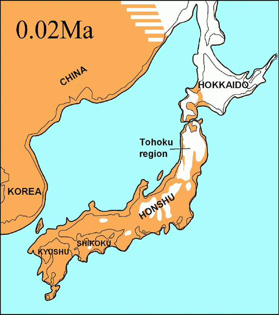
In this map, we see the modern-day map of Japan and eastern Asia. However, around the borders, we also see where the last Ice Age created land bridges connecting the mainland to Japan.
As you can see there was a definite land bridge that allowed people to simply walk to Japan from the north into Hokkaido.
And, near Korea, the distance between the islands was dramatically shortened. This helped the poorly crafted boats of the time survive the journey to Japan.
Major waves of influence during the prehistory era of Japan likely came from the Korean Peninsula and from the Russian area.
One other difference that you might have missed is that Japan itself was not made up of four major islands. It was practically one giant peninsula of Asia, and the modern-day Sea of Japan was practically just a giant lake (give or take a few dozen miles of land here or there)!
